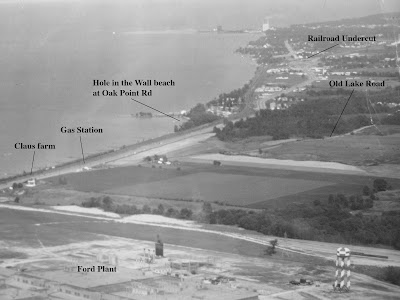
I've labeled a few of the landmarks for you so you can get your bearing. As you can see, there are a few things in the photo that relate to my posts of the last few days, including Hole-in-the-Wall beach.
What's interesting to me is that gas station that sits at the junction of Old Lake Road and newer Lake Road (Route 6). I've never been able to find the station in a city directory, since it's so far outside of Lorain.
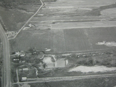
You could see it even better in the photo I posted yesterday (below).
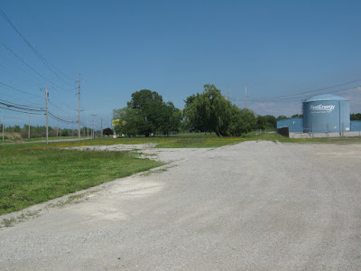
Today the area is unrecognizable from the photos, with the First Energy plant nearby. All that remains of the gas station is what looks like a little bit of its driveway. Here's a view looking east (below).
Here's an aerial view (below). The small triangular-shaped bit of concrete by the words "W Erie" at the bottom of the photo is where the gas station was located.
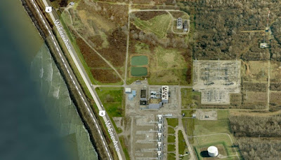
But the roadbed of Old Lake Road is still there, hidden from motorists racing by on its modern replacement.